
If you’re after an overnight, off-track experience right next to Sydney (and are reasonably fit), then put this walk in the Royal National Park on your list.
These are some rough track notes for a 19-20km walk from Waterfall to Engadine. It follows bush track and service trail for most of that length. However, there is a significant amount of off-track walking along Kangaroo Creek on Day 1. You should be fit and know how to navigate and self-rescue. I wrote up a more narrative version of this story for We Are Explorers.

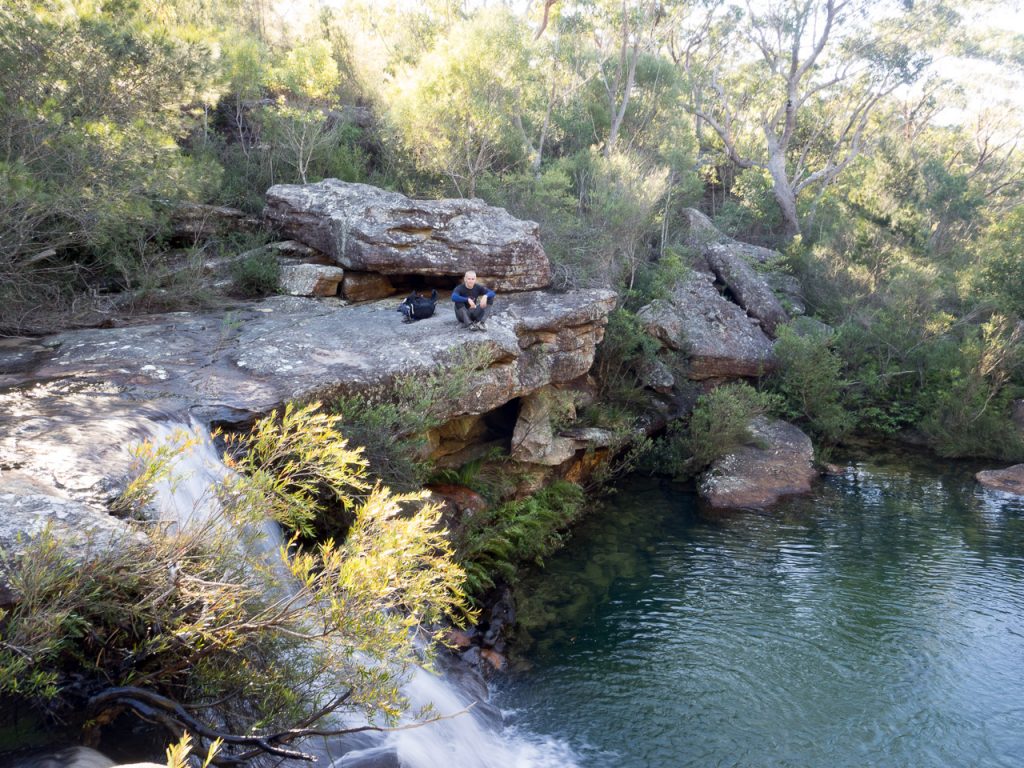
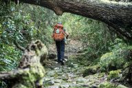
Garry contemplates the route ahead on Day 1, overlooking a beautiful small cascade on Kangaroo Creek
Getting there
Catch a train to Waterfall Station. From there it’s a short walk to the Uloola Track, which continues onto Uloola Falls – your destination for the night. However, the more scenic and strenuous option is to take an obvious turnoff to the left a hundred metres or so after the track’s start.
If you’re doing a car shuffle, park at Engadine Station and then catch a train to Waterfall.

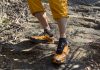
Garry rock hopping
Track Notes
Follow the rough bushtrail, marked with ribbons, down through some tea-tree and banksia scrub. Soon you’ll emerge onto a rock platform above a series of small waterfalls.
Scramble down the rocks to Kangaroo Creek and then follow another bush trail. You’ll pass small cascades before, eventually, you arrive at a massive pool fed by a 4m-high waterfall. This is where the track moves from being a trail to a “negotiable route”.
Probably the biggest waterfall on Day 1: the track disappeared soon after we found this place

Once the track ran out, we found it hard to find an established footpad and spent a lot of time bush bashing – but it was well worth it
For the next few kilometres you’ll be alternating between rock platforms, sandy banks, scrub-bashing and the occasional scramble up or down boulders. Parts of this section are just mind-blowingly beautiful.
Mostly you’ll stick to the right bank but don’t be afraid to go to the left bank if there’s a clearer route. Just make sure that you are back on the right bank after you walk past a 4-m high cliff on your right, when the creek swings left.

When you walk past this small cliff, make sure you’re on the right bank. Goondera Brook is not far off.
John and Lyn Daly’s track notes in Take a Walk: Southern NSW & the ACT suggest that there are rock cairns to help guide the way, but we saw only one or two, possibly because of the recent record storms and flood (or possibly because we’re terrible route finders). Either way, allow a couple of hours for this section of the track.
Eventually you’ll reach a vantage point over the pool where Goondera Brook joins Kangaroo Creek. We hit this spot about 4:15pm. Given that we were doing the walk in late June, we finished the last section to Karloo Pools (one of my favourite spots in RNP) in the dark – it was dicey going along some treacherous terrain. My friend Garry slipped and snapped a brand new trekking pole.
Once you’re at Karloo Pools, it’s an easy but steep walk up a bushtrail to Uloola Ridge. It will take 60-90 minutes to walk the 2km to Uloola Falls where there is a lovely little campground (bookings required). All up we were on the trail for well over 6 hours (I had allowed only 5).
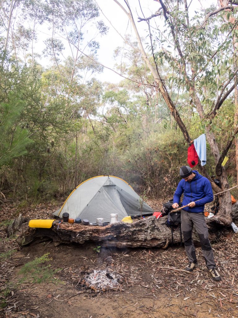
Uloola Falls campground: we camped with a Duke of Ed group but were able to find a nice private spot by ourselves.
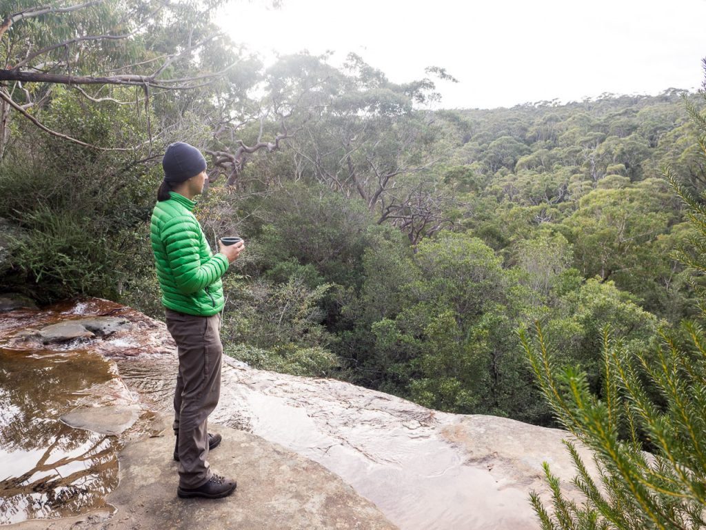
Enjoying a morning coffee looking out from the top of Uloola Falls (Photo: Garry Lomas)
Day 2, by comparison, is a walk in the park, albeit a hilly one. Follow the Uloola Track to Audley across the ridge until it joins up with Robertson’s Roundabout Circuit. Turn left (northward) and then turn left again (west) after 500 metres or so when you reach the Engadine Track. This leads steeply downhill to Kangaroo Creek Pools – another highlight on this walk.
After that, you’re only one steep hill and a few kilometres of ridgetop walking away from Engadine Station. Then it’s a train trip to the closest pub/fish n’ chips shop/loved one. You’ll enjoy your final destination so much more for the bush-bashing experience on Day 1.

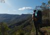
Garry sits atop a massive boulder at Kangaroo Creek Pools: another of the walk’s highlights.

Route finding required a mix of scrambling, rock-hopping and bush bashing
Video
If you want to get a real flavour for the walk, check out this video that I shot on a GoPro Session. Forgive the dodgy quality. This was my first effort with the camera and I’m still working out this whole video thing!


6 Comments
Looks interesting. Will put that on my to-do list… are there any nice off-track camping sites? Recently walked down Kangaroo Creek to the “Oympic Pool” (https://hikingtheworld.blog/2019/04/22/waterfall-to-engadine/) – also interested in exploring wether you can continue down Kangaroo Creek to the Engadine Track.
Hi Oliver. Yes – it’s one of my favourite walks in Sydney! It’s pretty steep and rough along the creek so I didn’t see any camp spots. There were a couple of large rock platforms that could potentially be used with freestanding tents though I wasn’t looking out for them. I’ve often wondered about continuing past Karloo Pool to Engadine Track via Kangaroo Creek. I have not read anything so it’s possible that either it’s impassable or, at the very least, you’d need to get your feet (and more) wet. Maybe we should try and do a link-up in Summer!
Hi James,
Great notes, I wish I’d read them before I came down this ‘track’. Update for 2020:
* I didn’t see any track markers downstream of the waterfall and in many places there is no
obvious best path to take. Much of the scrub along the banks was leaning downstream;
I imagine the Jan/Feb 2020 rain must have flushed through fairly heavily. Traversing the
trail upstream would be really hard yakka.
* I didn’t see any other person between the waterfall turnoff and Karloo pools on what
I would have expected to have been a reasonably busy day in the park (Father’s day).
* There’s no mobile reception.
So definitely one to take with appropriate caution. It’s also the slowest walk I’ve
recorded – something like 3 hours from Waterfall station to Karloo pools (~8.5km).
That said – wow – an absolutely spectacular bit of country and worth the effort.
(And with the absence of air traffic in 2020, you really do feel like you could be in the
middle of nowhere.)
Thanks for the update Bradley… Might be time for me to do the walk again! It’s been a few years. Totally agree how spectactular the creek is – hard to believe there’s such remote-feeling country within an hour of the the city! Sounds like you had the some struggles as we did. 3.5 hours might have been even faster than our efforts. Haha! There’d been massive rainfall and floods when we walked too – it had pretty much obliterated any trails and washed down a lot of debris. There were no track markers beyond the waterfalls when we did the walk either.
Footpad is very clear for about 3/4 of the way to Karloo past the top waterfall. Only unclear stretch is about 2/3 km before and after Gonderra Brook. Prior to that, surprisingly clear as long as you are going downstream (wouldn’t bother going upstream). Looks like the 2022 floods helped scour the banks, then quite a few people have been going this way lately. Crucial to descend the top waterfall on the true right (footpad in the scrub), then everything’s fine til after Cridland and before Gonderra. Shortly after the Gonderra creek junction, there are bits of tape and a couple of new cairns and a clear track again. No need to cross anymore to the left side. Still a bit of work especially in that vaguer section. Nowhere really good to swim from Cridland onwards either, so get your swims in earlier and later (I went out by Bottle Forest and the excellent pools downstream of Karloo).
Thanks so much for the update on the track notes Molly – and sincere apologies for the very delayed reply! I’m nowhere near as diligent with this blog as I should be. Hopefully the next person to walk this trail gets some value from your feedback. There’s been a hell of a lot of weather, as they say, since I walked all those years ago.